I’ve wanted to somehow make a seagull flying over Brighton for years. In my initial attempts, I used photogrammetry techniques to extract the google data! But finally, a legal method enabled by the good folk at Nasa who developed and published some open source code which they use to visualise Mars terrain.
I was able to get it to work with Google 3D tiles data in my own Threejs webgl environment which means I can get to play with the materials and interaction.
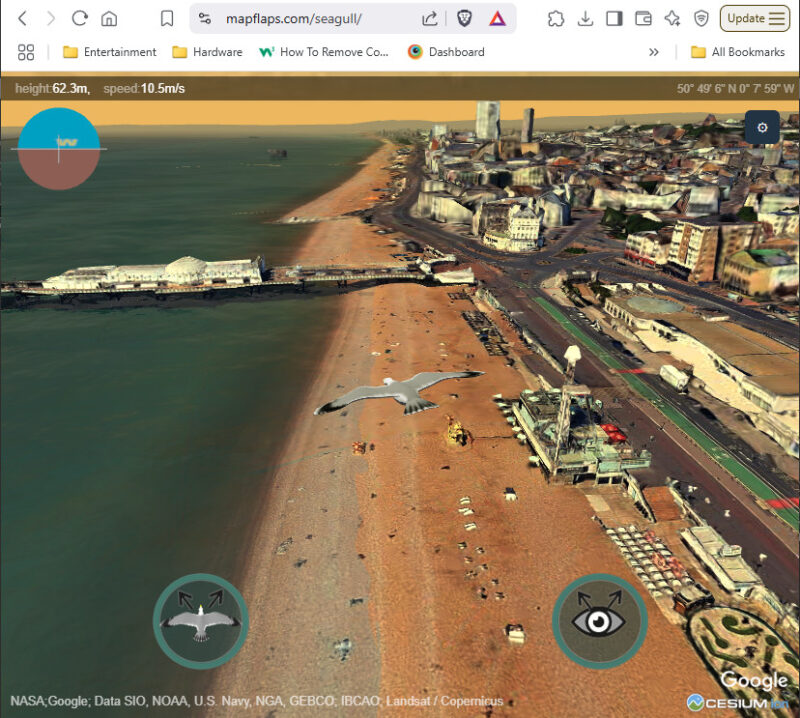
Google currently allow 1000 free tiles per month, but you should be able to try it here :
https://mapflaps.com/seagull/
So MapFlaps as a name kinda makes sense for being able to flap over a map right?
I had the website before a had the seagull flying, so it’s great to finally be able to justify my website name.